The Spanish island of La Palma has extended 43 hectares into the sea since the Cumbre Vieja volcano began erupting more than two months ago.
New images published by the European Earth observation programme, Copernicus, show the before and after of the island”s coastline.
Copernicus tweeted images from its Sentinel 1 satellite to show how the lava has increased the island’s size. The volcano first began erupting on 19 September.
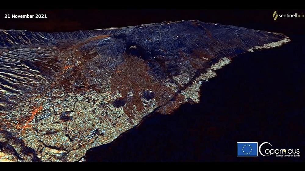
Images from the high-resolution optical satellite Sentinel 2 provide a closer look at the difference on the Spanish island in the Canaries.
Here’s a look at La Palma on 15 September — four days before the eruption began — compared to the island on 19 November.
Lava now covers an area of 1065.9 hectares of the island. Magma has also destroyed approximately 2,651 buildings since the start of the eruption.
Recently, more than 40 tremors have been recorded on the island, according to the National Geographic Institute, as the volcanic activity continues.
The strongest tremor was of magnitude 4.8 and took place in the municipalities of Villa de Mazo and Fuencaliente, where most of the seismic activity occurred.
On Tuesday, La Palma airport restarted its activity after cleaning the runway, “but the existence of winds from the south and southwest are causing an unfavourable scenario for air navigation due to the disposition of ash towards the east and northeast, which may impede the development of operations,” according to the Spanish National Geological Institute.