Media playback is unsupported on your device
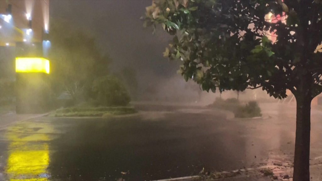
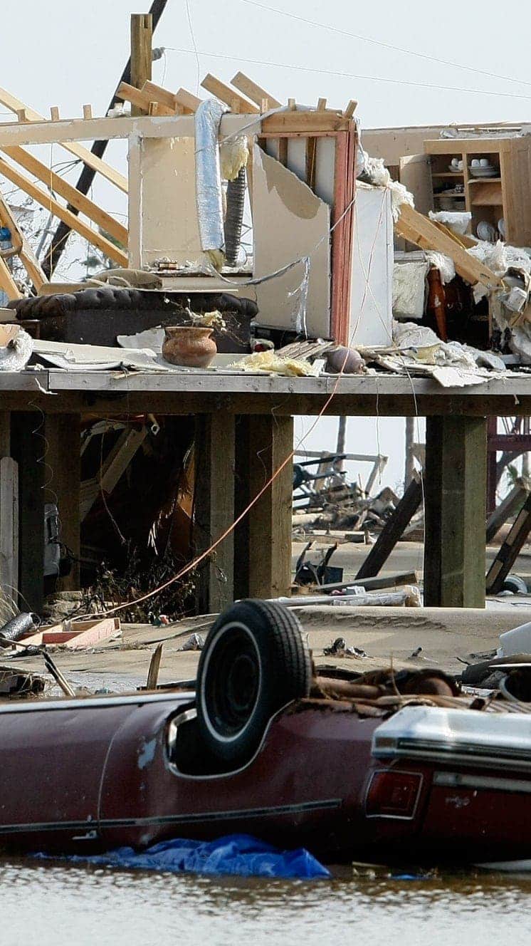
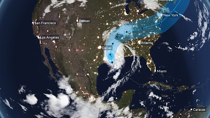
Hurricane Laura has made landfall in the US state of Louisiana, causing flash flooding and leaving hundreds of thousands of homes without power.
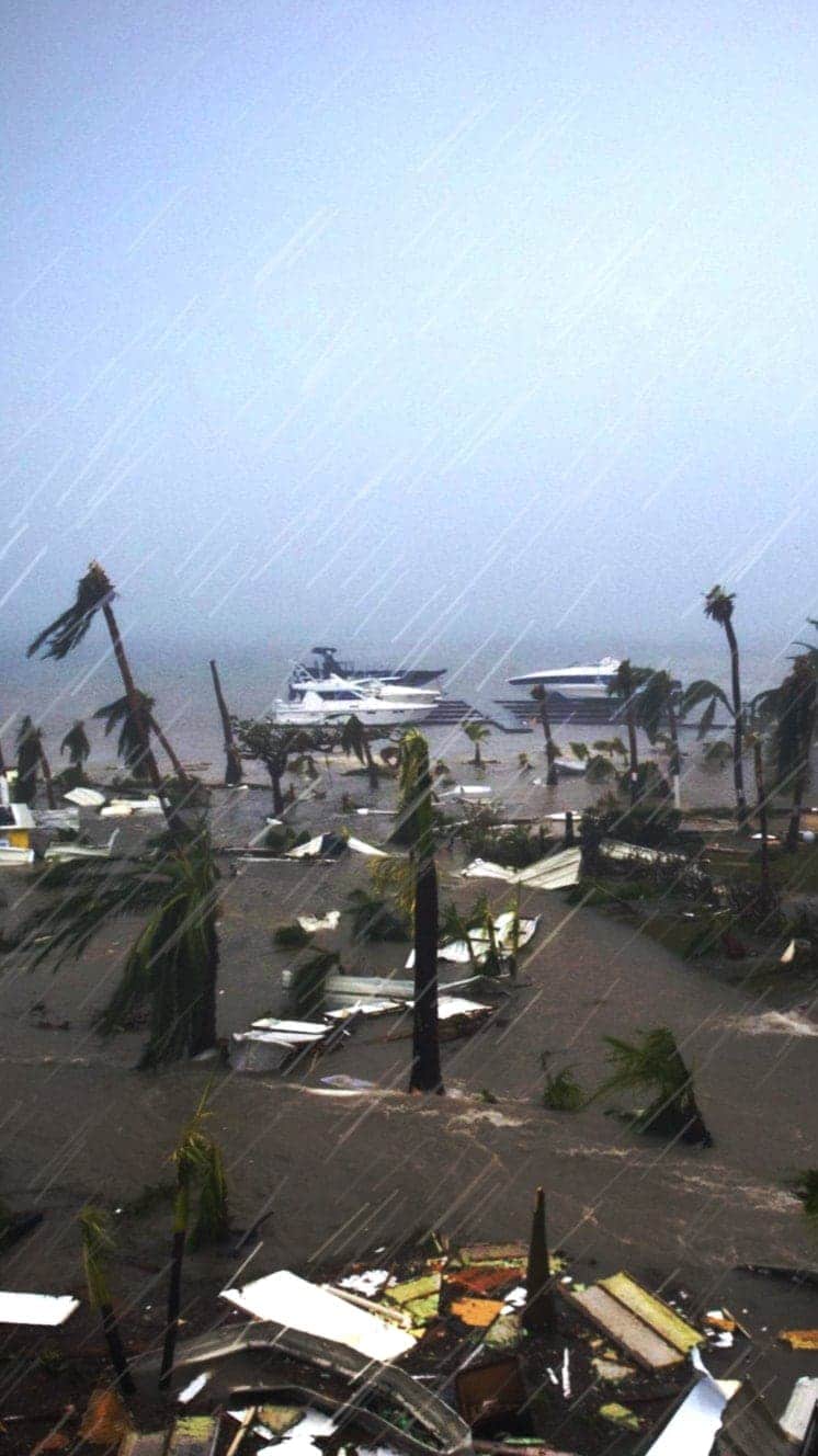
Forecasters earlier warned that the storm, a category four when it struck the coast with winds of up to 150mph (240km/h), threatened to cause an “unsurvivable” storm surge.
Hurricane Laura is one of the strongest storms to ever hit the US Gulf Coast.
Half a million residents have been told to leave parts of Texas and Louisiana.
Hurricane Laura made landfall shortly after midnight local time (05:00 GMT) near the district of Cameron, in Louisiana. By 04:00, it had been downgraded to a category three storm, with winds of up to 130mph (208km/h), the National Weather Service (NWS) reported.
The storm has since been downgraded further, to category two, and is expected to continue weakening as it moves inland.
The NWS said that the “unsurvivable storm surge… could penetrate up to 40 miles inland from the immediate coastline, and flood waters will not fully recede for several days”.
More than 390,000 homes in Louisiana reportedly lost power in the early hours on Thursday, according to the US tracking site PowerOutage. In Texas, more than 100,000 homes suffered power cuts.
Hurricanes
A guide to the world’s deadliest storms
Hurricanes are violent storms that can bring devastation to coastal areas, threatening lives, homes and businesses.

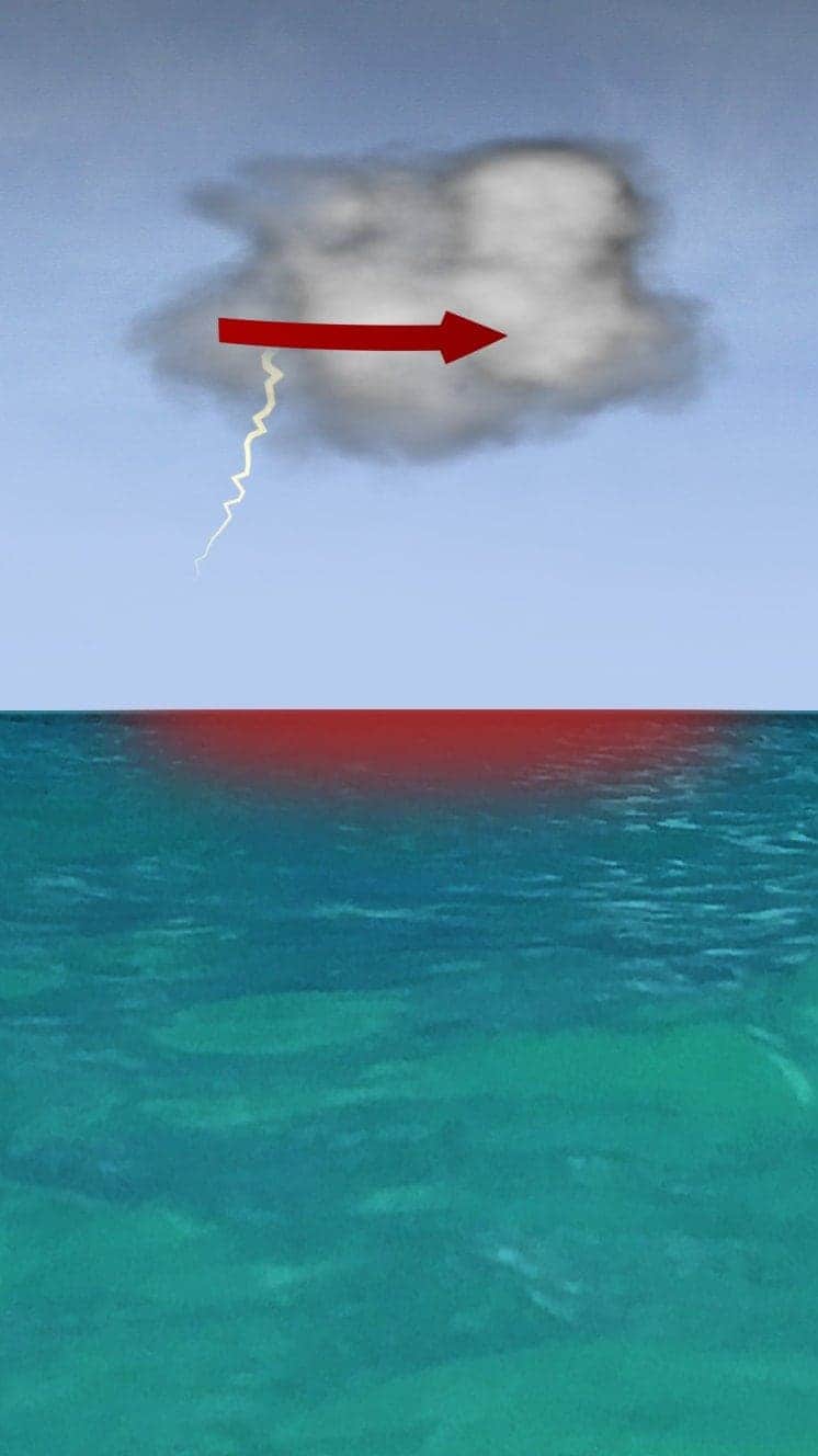
Hurricanes develop from thunderstorms, fuelled by warm, moist air as they cross sub-tropical waters.
Warm air rises into the storm.
Air swirls in to fill the low pressure in the storm, sucking air in and upwards, reinforcing the low pressure.
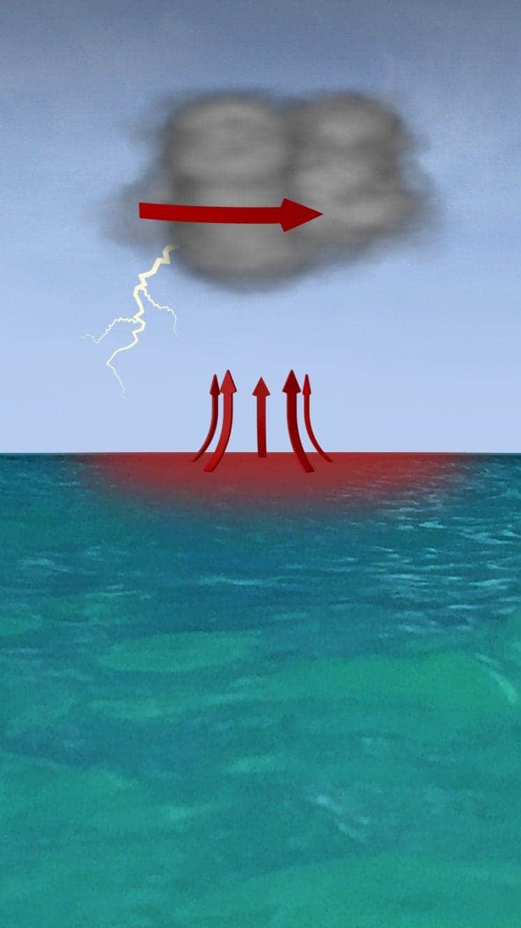
The storm rotates due to the spin of the earth and energy from the warm ocean increases wind speeds as it builds.
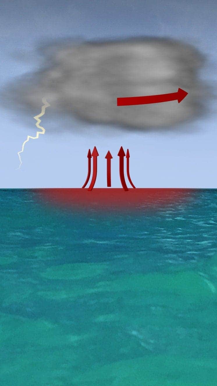
When winds reach 119km/h (74mph), it is known as a hurricane – in the Atlantic and Eastern Pacific – or a typhoon in the Western Pacific.

“Everybody has a plan until they get punched in the face. Well, we’re about to get punched in the face.”
Florida Mayor Bob Buckhorn, ahead of Hurricane Irma (2017)
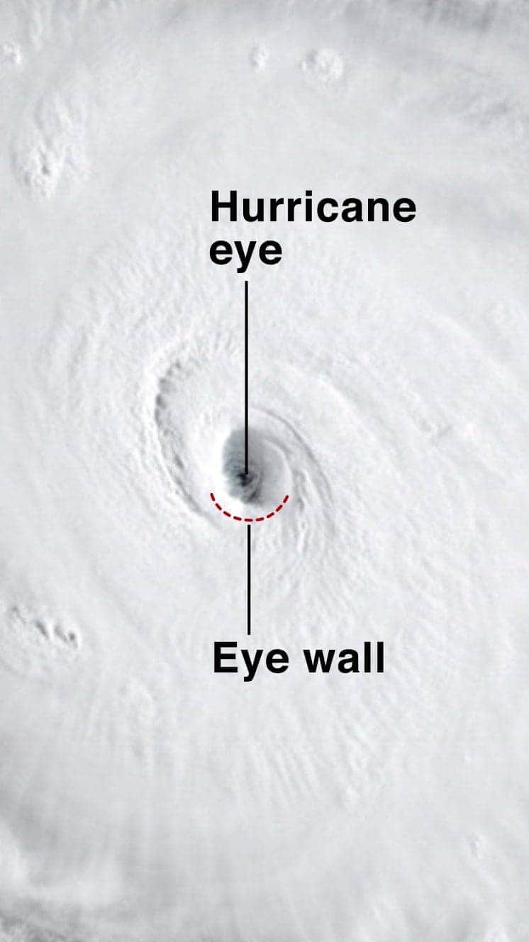
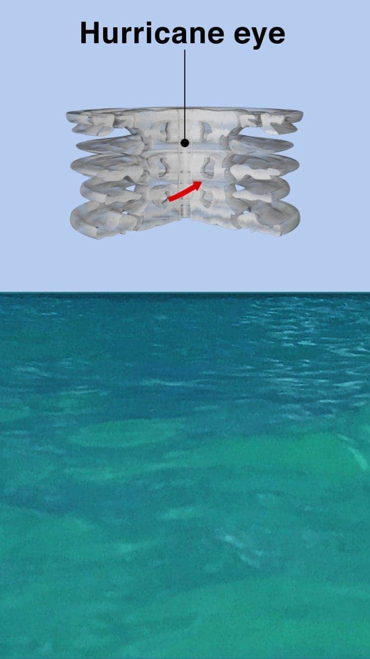
The central eye of calmer weather is surrounded by a wall of rainstorms.
This eyewall has the fastest winds below it and violent currents of air rising through it.
A mound of water piles up below the eye which is unleashed as the storm reaches land.
These storm surges can cause more damage from flooding than the winds.

“Urgent warning about the rapid rise of water on the SW FL coast with the passage of #Irma’s eye. MOVE AWAY FROM THE WATER!”
Tweet from the National Hurricane Center
The size of hurricanes is mainly measured by the Saffir-Simpson scale – other scales are used in Asia Pacific and Australia.
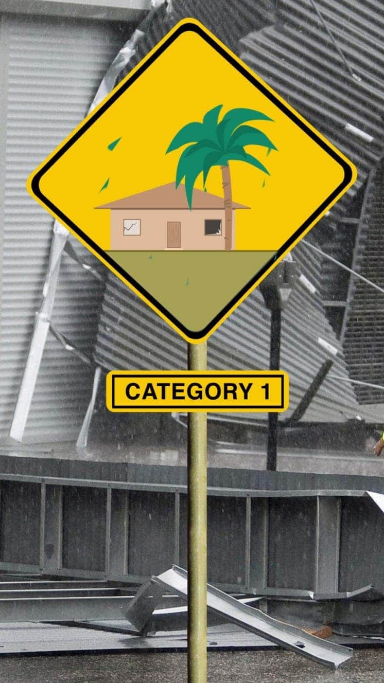
Winds 119-153km/h
Some minor flooding, little structural damage.
Storm surge +1.2m-1.5m
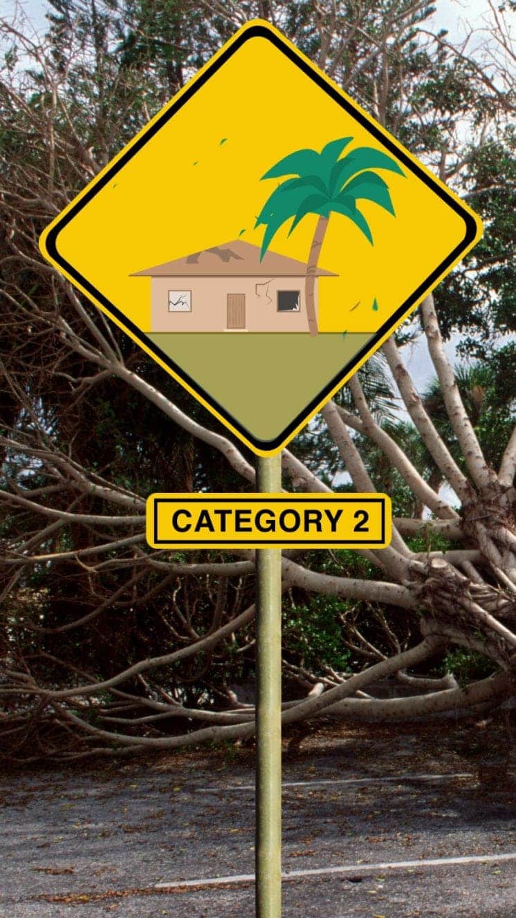
Winds 154-177km/h
Roofs and trees could be damaged.
Storm surge +1.8m-2.4m
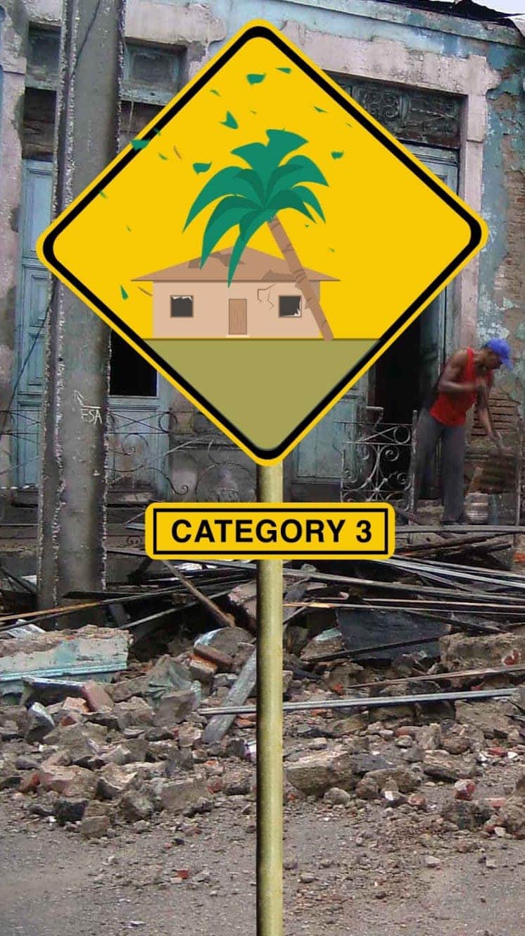
Winds 178-208km/h
Houses suffer damage, severe flooding
Storm surge +2.7m-3.7m
Hurricane Sandy (2012) caused $71bn damage in the Caribbean and New York
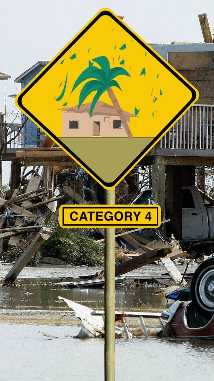
Winds 209-251km/h
Some roofs destroyed and major structural damage to houses.
Storm surge +4m-5.5m
Hurricane Ike (2008) hit Caribbean islands and Louisiana and was blamed for at least 195 deaths
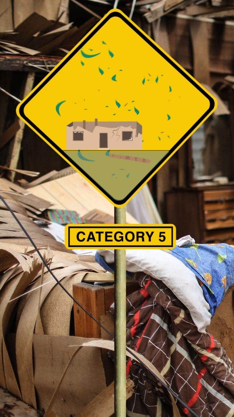
Winds 252km/h+
Serious damage to buildings, severe flooding further inland.
Storm surge +5.5m
Hurricane Irma (2017) caused devastation in Caribbean islands, leaving thousands homeless
“For everyone thinking they can ride this storm out, I have news for you: that will be one of the biggest mistakes you can make in your life.”
Mayor of New Orleans Ray Nagin ahead of Hurricane Gustav, 2008
The National Hurricane Center (NHC) earlier warned any residents remaining in or near the path of the “catastrophic” storm to “take action now to protect your life… in a reinforced interior room away from windows”.
“Get under a table or other piece of sturdy furniture,” the NHC said, adding: “Use mattresses, blankets or pillows to cover your head and body.”
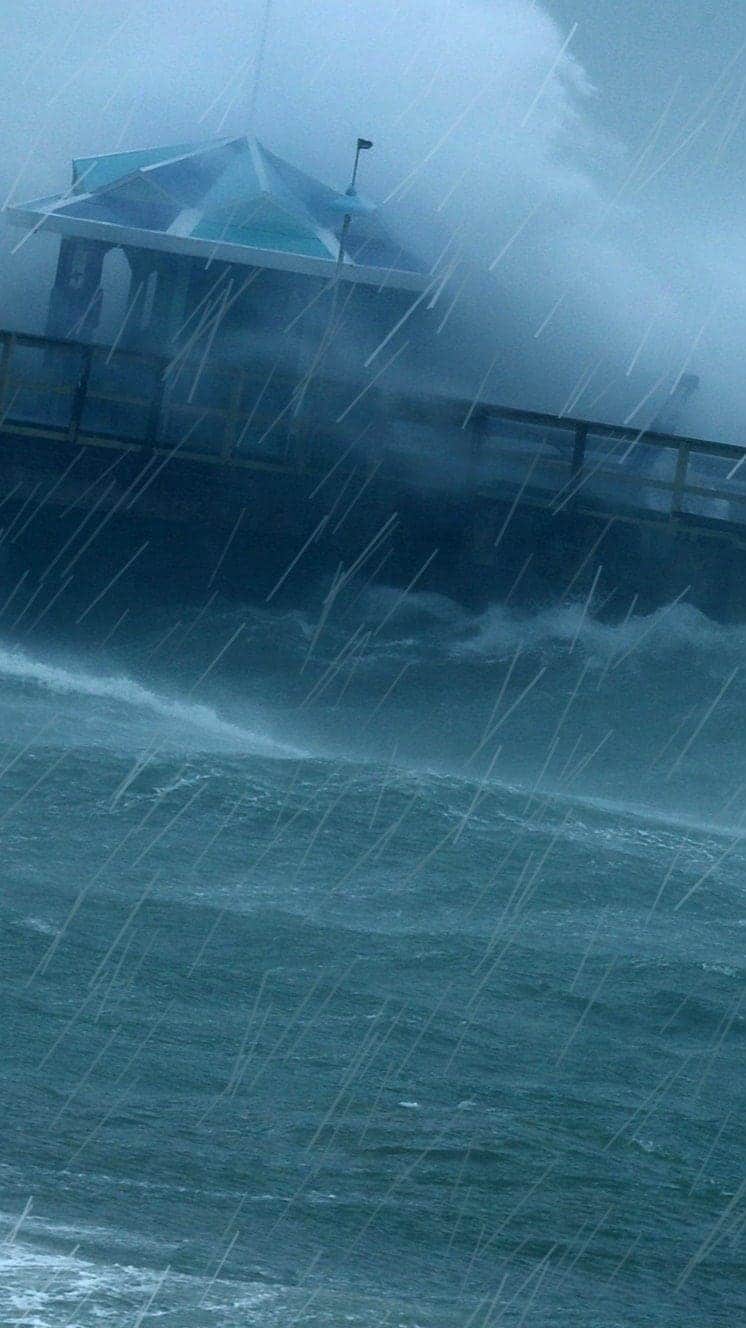
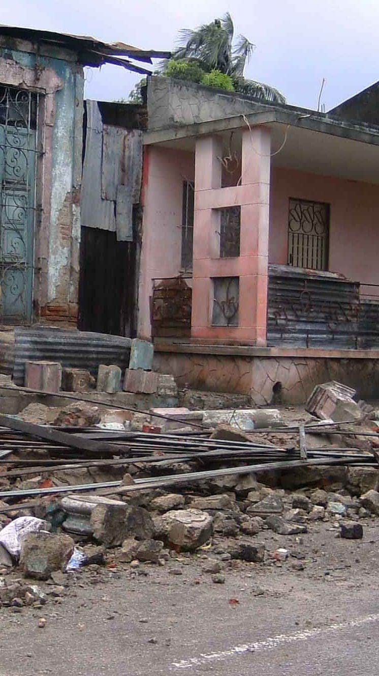
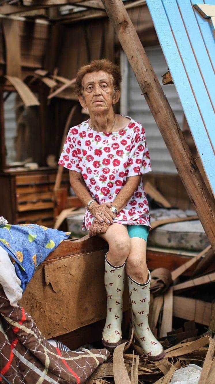
Television footage showed heavy rain and strong winds lashing the coastal city of Lake Charles in south-west Louisiana. Buildings have reportedly been damaged and trees ripped from the ground.
Image copyright
Reuters
Parts of Louisiana have already seen flooding
Laura and another storm, Marco, earlier swept across the Caribbean, killing 24 people. Marco struck Louisiana on Monday, bringing strong winds and heavy rain.
Initially it was feared that both storms would hit Louisiana as hurricanes within 48 hours of each other – an unprecedented event – but Marco was downgraded to a tropical storm.
Media playback is unsupported on your device
While Laura strengthened rapidly on Wednesday from category three to category four, it weakened in the hours after reaching the Louisiana coast.
Hurricane Katrina – which devastated New Orleans in 2005, killing more than 1,800 people – was a category five storm before weakening to a category three when it made landfall in the US. Broken levees led to disastrous flooding in the city of New Orleans, which sits some 6ft (2m) below sea level, making it particularly vulnerable to storms.
- Hurricanes: A guide to the world’s deadliest storms
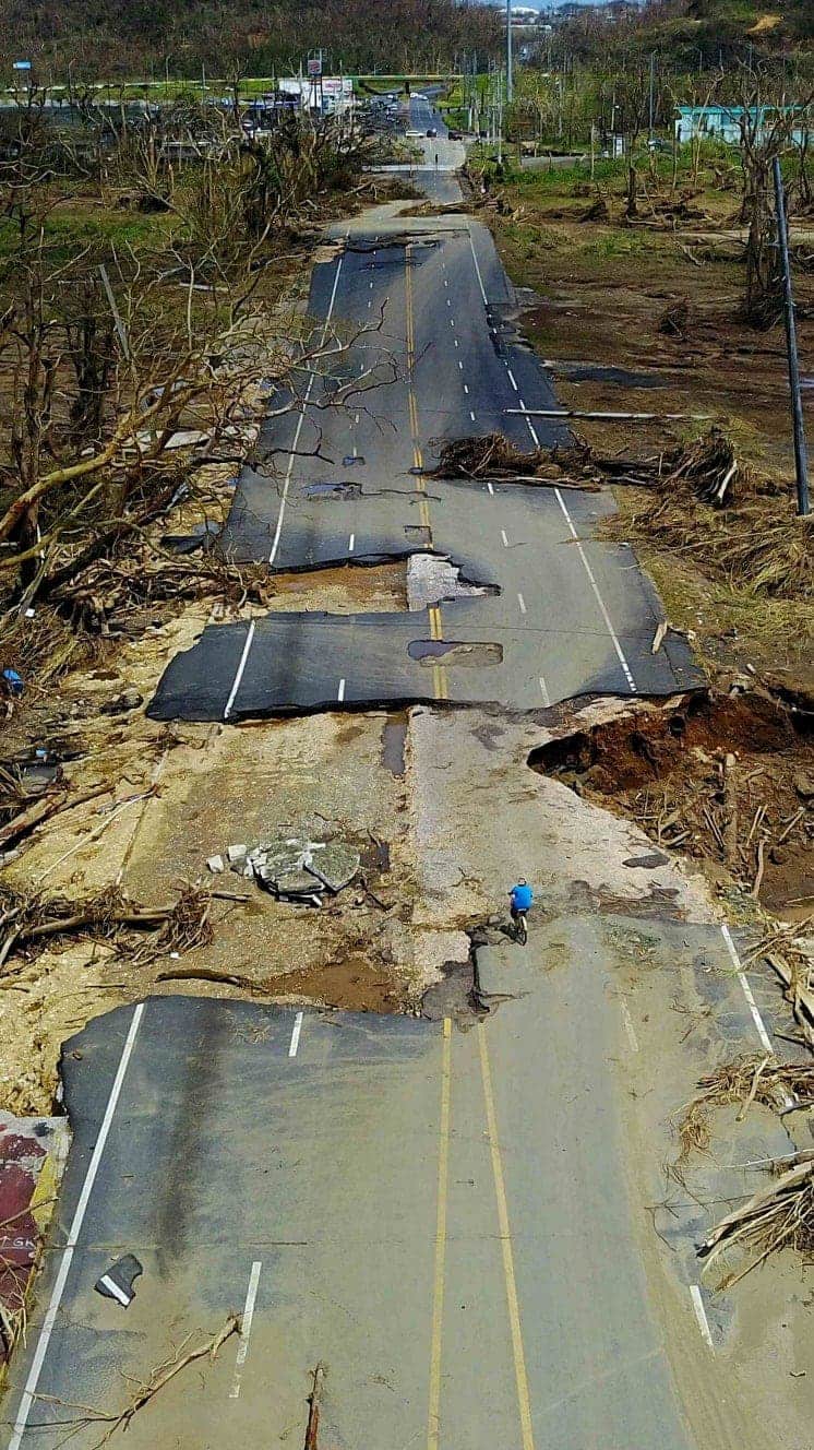
- Warming makes bigger hurricanes more damaging
US President Donald Trump told those potentially affected by the storm to “listen to local officials” as the storm was “very dangerous and rapidly intensifying”.
Evacuations are complicated by the Covid-19 pandemic. Texas Governor Greg Abbott urged families who could afford it to take refuge in hotels and motels to be distanced from others.
What more can we expect from Hurricane Laura?
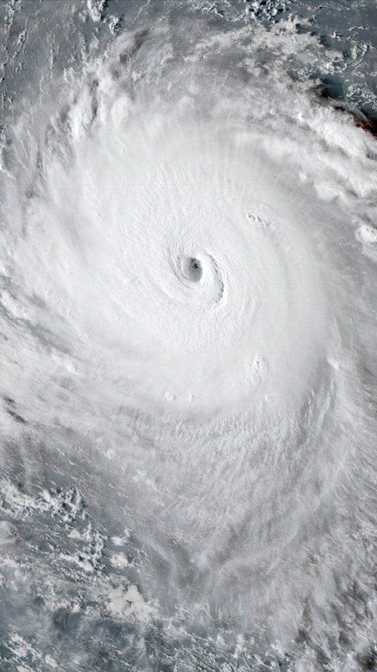
On Wednesday, the NHC said satellite images had shown that Laura had undergone a remarkable intensification to become a “formidable hurricane”.
In a series of tweets, it said Laura was expected to bring “life-threatening hazards” to parts of the coast of the Gulf of Mexico.
Well-built homes could incur major damage, trees were likely to be snapped or uprooted and electricity and water would be unavailable for days or even weeks, it said.
“Hurricane force winds and widespread damaging wind gusts will also spread well inland into portions of eastern Texas and western Louisiana early Thursday,” the NHC added.
Storm surges of more than 20ft (6m) are possible. “To think that there would be a wall of water over two storeys high coming on shore is very difficult for most to conceive, but that is what is going to happen,” said NWS meteorologist Benjamin Schott.
“The word ‘unsurvivable’ is not one that we like to use, and it’s one that I’ve never used before,” he added.
Governor Abbott urged people in the path of the storm to “take advantage of these final few hours to evacuate”.
“The power of Hurricane Laura is unprecedented, and Texans must take action now to get out of harm’s way and protect themselves,” he said.
Image copyright
EPA
Businesses in Louisiana boarded up windows as Hurricane Laura approached
More than 420,000 Texas residents have been ordered to leave, while an additional 200,000 were told to evacuate Calcasieu Parish in south-western Louisiana.
Port Arthur, Texas, is home to the nation’s largest oil refinery, and workers have been taken off at least 310 offshore facilities in the Gulf of Mexico, reducing oil production by 84% for a second day in a row, officials said.
Have you left the area? What is the situation like where you are? Share your experiences by emailing [email protected].
Please include a contact number if you are willing to speak to a BBC journalist. You can also get in touch in the following ways: